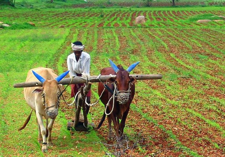
Modi govt- increases rural development
Narendra Modi-led government has taken a transformative step by employing drones to survey 67,000 sq km of land spanning over 3 lakh villages. This ambitious initiative is part of the government's SVAMITVA (Survey of Villages and Mapping with Improvised Technology in Village Areas)
POLITICS
1/19/20253 min read
PM Modi Government Uses Drone Technology for Land Survey in 67,000 Sq Km: A Game Changer for India's Development
The Narendra Modi-led government has taken a transformative step by employing drones to survey 67,000 sq km of land spanning over 3 lakh villages. This ambitious initiative is part of the government's SVAMITVA (Survey of Villages and Mapping with Improvised Technology in Village Areas) scheme, launched in 2020 to modernize India's land records and foster rural development. Let’s break down the motive, benefits, and potential growth impact of this program.
Motive Behind the Drone Survey
1. Streamlining Land Records: India's land records are often outdated, ambiguous, and plagued with disputes. The drone survey aims to:
Digitize and map land boundaries accurately.
Resolve land ownership disputes.
Establish legal ownership for villagers through property cards.
2. Promoting Economic Empowerment:
Providing villagers with property ownership enables them to use their land as collateral for loans.
Boosts entrepreneurship and financial inclusion in rural areas.
3. Reducing Land-Related Conflicts:
A significant portion of legal cases in India arises from land disputes. Clear records can prevent these disputes and ease the burden on the judiciary.
4. Enabling Infrastructure Planning:
Accurate land data facilitates better rural infrastructure planning, including roads, schools, and healthcare facilities.
Benefits of the Initiative
1. Transparent Land Ownership
Fact: According to a report by NITI Aayog, over 66% of civil cases in Indian courts pertain to land disputes.
Benefit: With drones creating high-resolution maps, villagers will receive ‘Property Cards’ (legal documents confirming ownership), reducing litigation and fostering trust.
2. Boost to Rural Economy
With ownership rights, villagers can:
Access institutional loans for farming or business.
Leverage government schemes like the Mudra Loan Scheme for small enterprises.
Example: A farmer with a verified land title can avail loans at lower interest rates, boosting agricultural productivity.
3. Accelerated Infrastructure Development
Clear land data helps in identifying government-owned land and streamlining public projects.
Example: Rural roadways under the Pradhan Mantri Gram Sadak Yojana (PMGSY) can now be planned efficiently.
4. Improved Governance
The integration of drone data with Geographic Information Systems (GIS) provides policymakers with tools to monitor land use, plan utilities, and curb encroachments.
5. Digitization and Reduced Corruption
Moving from paper-based to digital land records reduces bureaucratic bottlenecks and minimizes corruption at the grassroots level.
Impact on India’s Growth
1. Supporting the $5 Trillion Economy Goal
Accurate land titles are a cornerstone for investment in rural sectors like agriculture, renewable energy, and real estate. Property cards could unlock $200 billion in rural economic potential, as per estimates by World Bank economists.
2. Boosting Agricultural Productivity
Fact: India has 195 million hectares of agricultural land, but fragmented holdings reduce efficiency.
Impact: With digitized records, land consolidation and efficient farming techniques can be implemented, boosting productivity.
3. Enabling Smart Cities in Rural Areas
The initiative complements schemes like the Digital India Mission by providing the foundation for GIS-based urban planning in rural clusters.
4. Increased Employment
Survey and mapping activities generate skilled employment opportunities in fields like drone technology and GIS.
5. Climate-Resilient Planning
High-resolution drone maps aid in monitoring soil erosion, flood zones, and water resources, enabling sustainable land-use practices.
Challenges and Solutions
1. Challenge: Lack of Awareness
Many rural villagers may be unaware of the significance of property cards.
Solution: Conduct awareness campaigns and workshops in local languages.
2. Challenge: Resistance to Change
Fear of losing land due to incorrect records might lead to resistance.
Solution: Transparent grievance redressal mechanisms should be implemented.
3. Challenge: Infrastructure Limitations
Drone mapping requires robust IT infrastructure.
Solution: Strengthen rural digital infrastructure under BharatNet.
Global Examples Supporting the Move
Rwanda: Used drones for land surveys, leading to a 70% reduction in land disputes.
Indonesia: Leveraged drones for forestry and land use, aiding in conservation and rural development.
Conclusion
The Modi government’s drone-based land survey initiative under SVAMITVA is a transformative step toward empowering rural India. By digitizing land records, the program ensures transparency, resolves disputes, and unlocks economic potential, contributing significantly to India's GDP. With proper implementation, this initiative could bridge the urban-rural divide and establish a foundation for inclusive growth, taking India closer to its vision of becoming a $5 trillion economy.